20th Jul, 2022 10:30
Militaria, Maps & Ethnographica

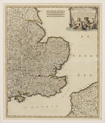
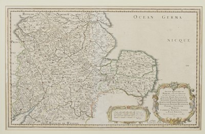
A LATE 17TH / EARLY 18TH CENTURY DUTCH MAP OF SOUTHEAST ENGLAND BY DE WITT, AND ANOTHER BY SANSON
LATE 17TH / EARLY 18TH CENTURY DUTCH MAP OF SOUTHEAST ENGLAND,
by Frederik De Witt, 'Regni Angliae [...]', 58cm x 50cm, together with a 17th century French example by Sanson, 'Anciens Royaumes de Mercia et East-Angles', 36cm x 37.5cm, both mounted (2)
A Private Scottish Highlands Collection
A condition report is offered as an indication of any issues visible to the naked eye. As none of our staff is a professional conservator or restorer, buyers must satisfy themselves in respect of condition. The condition report does not form part of any contract between McTear's and the buyer, and all lots are offered "as is" in accordance with our Terms of Business available on our website.
Sold for £50
Estimated at £50 - £100
Condition Report
An original and period map(s)
Request a free auction estimate
Complete the form below and one of our specialists will get back to you.

