Classic Cartography
Within our upcoming Works of Art, Furniture, Medals & Militaria auction (22 November), we will be offering a selection of five fine maps dating from the late 17th to the late 18th centuries. Maps from this period, often referred to as ‘The Enlightenment’, have long been sought after by collectors, and can be seen to represent a pivotal point in the history of cartography.
Key to this revolution was the far greater demand for largescale mapmaking projects in an age characterised by exploration and scientific advancement. Furthermore, the critical switch from coarse woodcut engraving to a more durable intaglio plate method allowed for greater runs of more detailed maps.
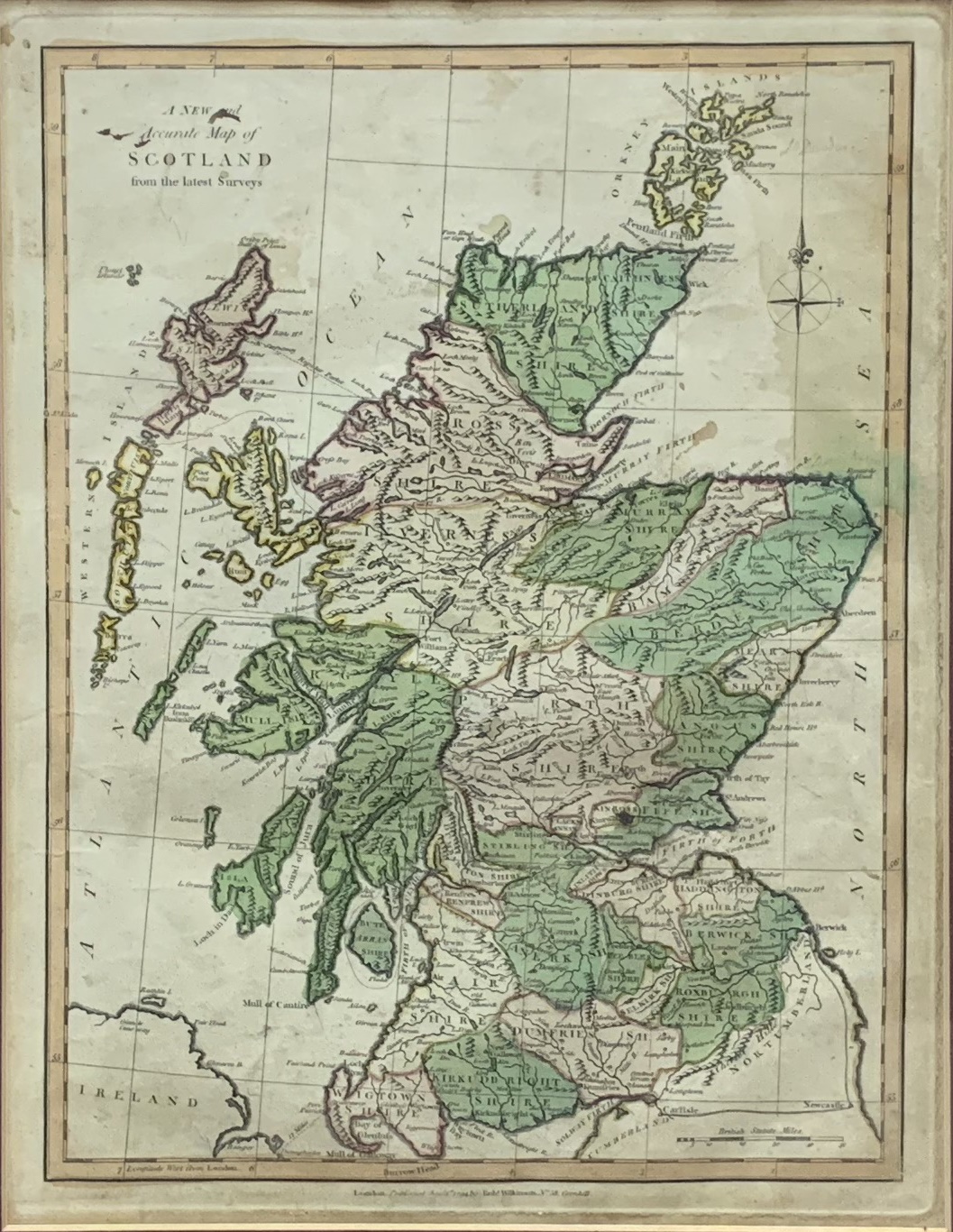
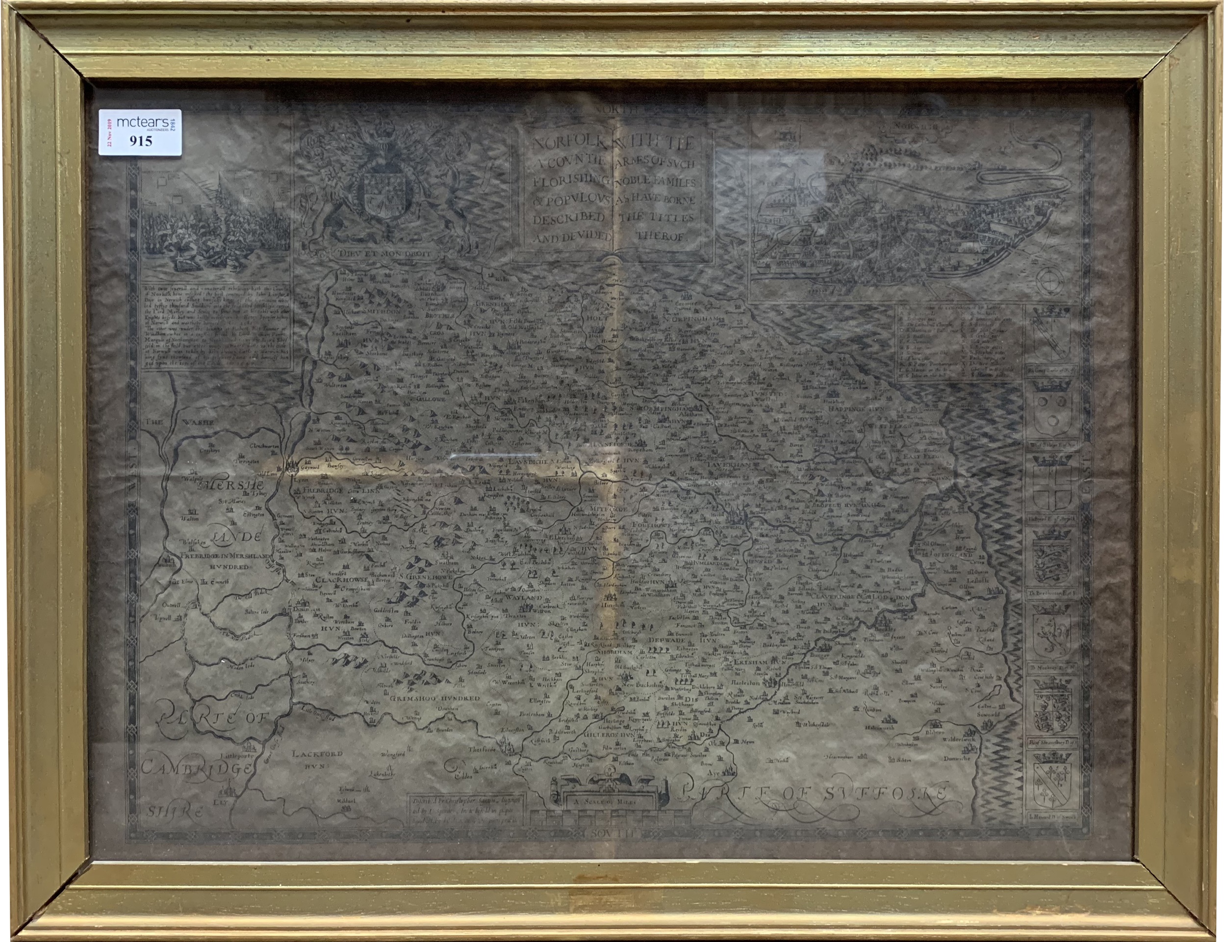
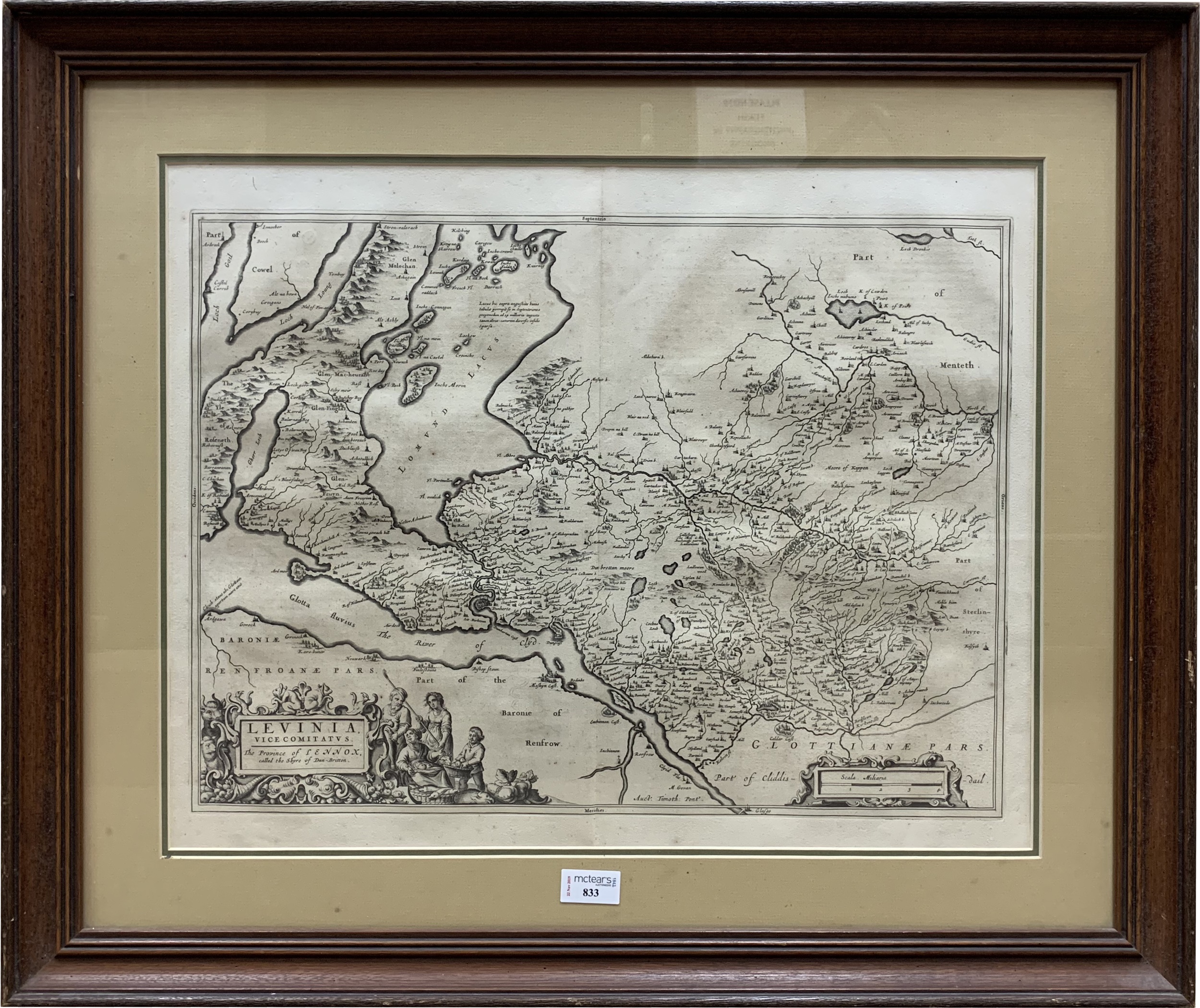
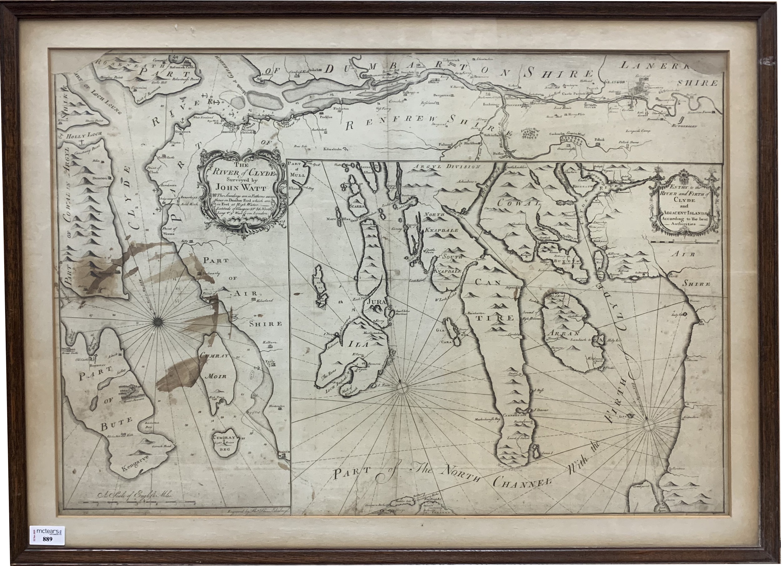
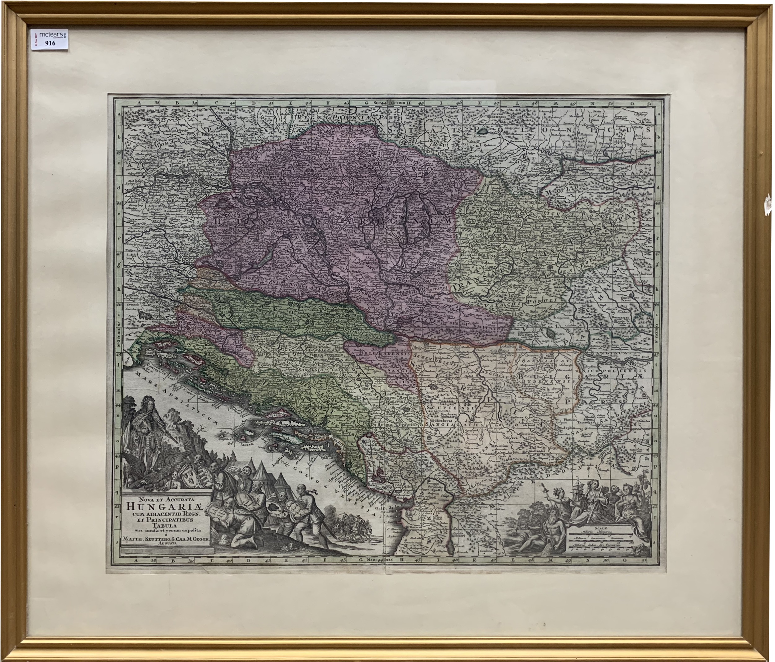
Of the five works coming to sale, the first four focus on the nation of Britain (Lots 833, 889, 914 and 915), including both a map of Norfolk by the esteemed English cartographer Christopher Saxton (1540-1610), as well as a rare early example of Glasgow’s own Clyde. The final work (Lot 916) looks to the continent, this one being an early 18th century map of the country of Hungary by the prolific German cartographer George Matthaus Seutter (1678-1757).
With estimates ranging from £40-250, and subject matter from rivers to counties to countries, there really is something for everyone, so make sure to map out your route to McTear’s in advance!
Click to view full auction catalogue >>
James Bruce
Entries are invited for the next auction on 31st January. For a complimentary valuation contact Hannah Murphy on 0141 810 2880 or hannahmurphy@mctears.co.uk.
What's it worth?
Find out what your items are worth by completing our short valuation form - it's free!